Follow this link to skip to the main content
jpl header
JPL Home Earth Solar System Stars & Galaxies Science & Technology
JPL Email News RSS Podcast Video

Wetlands wetlands globe
Home
Project
Instruments
Data
Links
Tools
Team
Marshland
Wetlands - Data
Global DEM: Introduction

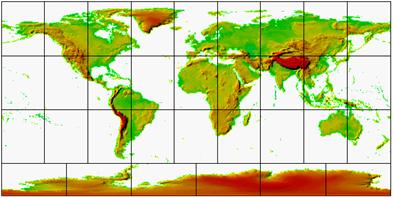
Global Digital Elevation Model

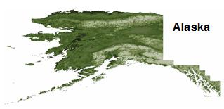
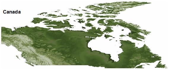
Digital elevation models (DEMs) describe terrain elevation variations. The global DEM presented on this website is a result of various data sets acquired from land surveying on the ground to remote sensing from radars on orbiting satellites. All input data sets have been processed and formatted to a consistent and convenient configuration to aid in research demanding high quality DEMs. Below are descriptions of the different input DEM data sets used. For an overview on the processing techniques used to produce the global output DEM, click here.

2D DEM
A DEM: black represent water while lighter regions represent higher elevation.
Shuttle Radar Topography Mission

SRTM was an 11 day mission onboard the space shuttle Endeavour, lead by the National Geospacial Agency (NGA) and NASA on February 2000. Using a technique known as interferometric synthetic aperture radar, the shuttle was able to obtain a near global DEM at a resolution of 1-arcsecond. This data has been released globally at 3-arcseconds and at 1-arcscond for the region covering the US. CGIAR-CSI has further processed the DEM by filling data voids. Despite its high resolution, SRTM data is only present between 56 °S and 60 °N, which covers about 80% of the Earth’s landmass. Due to this limitation other DEM data sets are used to cover missing regions.
SRTM Map
The SRTM Coverage Map: SRTM data covers land between 56 °S and 60 °N.
GTOPO30

GTOPO Map
The GTOPO30 Coverage Map: GTOPO30 covers all of Earth's landmass.
GTOPO30 is a global DEM covering the entire planet at 30-arcseconds resolution. It was developed by the staff of the United States Geological Survey (USGS) form several raster and vector sources. Due to its low resolution, GTOPO30’s quality is very coarse compared to higher resolution DEMs; yet it is useful in filling data voids and supplementing regions not covered by other data sets.

Alaska and Canada DEMs
Alaska DEM
Alaska DEM
The Alaska DEM is part of the National Elevation Dataset (NED), developed by USGS. At 2-arcsecond resolution, the Alaska DEM serves as a supplement to SRTM missing data north of 60 °N.

Canada DEM
The Canada DEM also helps fill missing regions in North America. This data set was developed by GeoBase at a latitudinal resolution of 3-arcseconds and a longitudinal resolution of 6-arcseconds

Canada DEM

<< Data Processing Methodology >>


JPL Footer
JPL Footer - Feedback Button JPL Footer - FAQ button JPL Footer - Image Policy Button JPL Footer - Privacy Button Mail to: Wetlands